GeoListInput
Smartsite 7.1 - ...
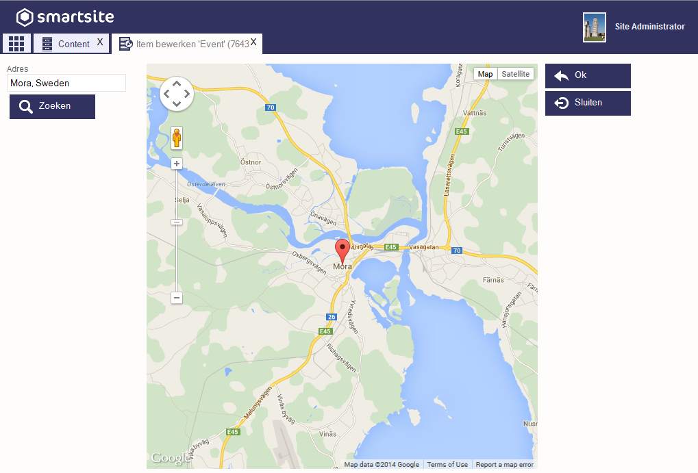
The geo list input allows the user to create and edit a list of geographic locations which can be pointed out on a map in a sub-action using Google Maps. The initial location, zoom level and map type can be set through field properties. It's also possible to include any number of kml files by adding a layer config file.
The following properties are supported by (and define the control as being) the geo list input
| Name | Example | Description |
|---|---|---|
| GeoAddress | Elektronicaweg, Delft | Address that will be searched for as the initial position of the map. |
| GeoPosition | 51.99609, 4.38371 | Comma separated latitude, longitude coordinates for the initial position of the map. |
| GeoZoom | 12 | Inital zoom level. |
| GeoMapType | Satellite | Initial map type. [Roadmap,Satellite,Hybrid,Terrain] |
| GeoLayerConfig | ../System/layers.txt | Link to a text file containing a list of line break-separated urls to kml files. The kml layers will be added to the map. Google Maps will move and zoom the map to include all the added layers in the view port, overriding GeoZoom, and possibly placing the inital marker out of view. |
In the Edit item form, the geo list input looks like this
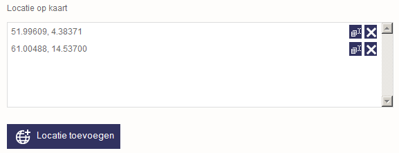
Notice that thecoordinates in each entry are separated by a comma. Because of this, the default delimiter used by the geo list input is the pipe character (|).
The Google Maps sub-action: